
Street View opens campus to virtual tourists
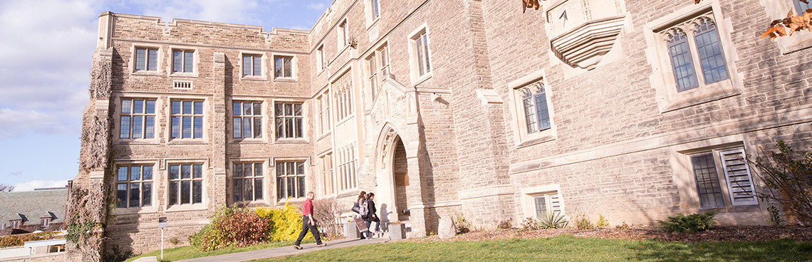
[img_inline align=”right” src=”http://padnws01.mcmaster.ca/images/hamiltonhallstreetview.jpg” caption=”McMaster’s Hamilton Hall, one of the first five buildings constructed after the University moved to Hamilton, as seen in Google’s Street View. The search engine company was on campus in the summer with a modified car and tricycle that it used to photograph McMaster’s pathways for the project. Screen capture via Google.”]Potential students, curious community members, reminiscent alumni: people the world
over can now tour McMaster University without leaving their homes, thanks to Google's
Street View project.
McMaster is among the first universities in Canada to have its campus walkways
mapped by Google's Street View project, which provides 360-degree, street-level
photographic imagery from roads and paths all around the world.
Google staff were on campus in July with a car and tricycle specially modified with a
camera system that allows them to take 360-degree photos.
The car, outfitted with 15 lenses to take photos, lasers to capture 3D data, motion
sensors to track its position, a computer and a hard drive, is used to snap shots of
roadways. The tricycle is used to map walkways, bike paths, parks, trails and even
sports stadiums.
Google also employs a Street View snowmobile, originally created for the Vancouver
Winter Olympics, and a trolley system, developed to expand Street View into museums
and galleries.
To create the 360-degree images, Google staff first drive the vehicles around to collect
photographs. Using data from GPS systems on the vehicles, the photos are aligned to
their specific locations on Google Maps and then “stitched” together to create a
continuous panorama. The resulting image is then re-projected onto a sphere to lessen
distortion.
Identifiable faces and vehicle license plates are blurred, and users can request further
blurring of specific images.
McMaster University can be found on Google maps here. To use Street View, drag the
orange figure from the navigation area to the map of campus.
