
(Mc)Masters of the Air: Library maps star in wartime series

Austin Butler is one of the stars in the wartime production "Masters of the Air" on Apple TV+.
What do actors Austin Butler, Callum Turner and Barry Keoghan have in common with McMaster University Library maps?
They all star in the highly anticipated Second World War drama, Masters of the Air, which debuted on Apple TV+ this month.
“McMaster University Library has a fantastic military map collection, but what draws us apart is the fact that our materials are digitized and well-described,” said Saman Goudarzi, cartographic resources librarian at McMaster library. “We are considered one of the biggest players in the field of military maps.”
Based on Donald L. Miller’s book of the same name, Masters of the Air follows the men of the 100th Bomb Group, known as the “Bloody Hundredth,” as they conduct bombing raids over Nazi Germany and grapple with the frigid conditions, lack of oxygen, and terror of combat conducted at 25,000 feet in the air.
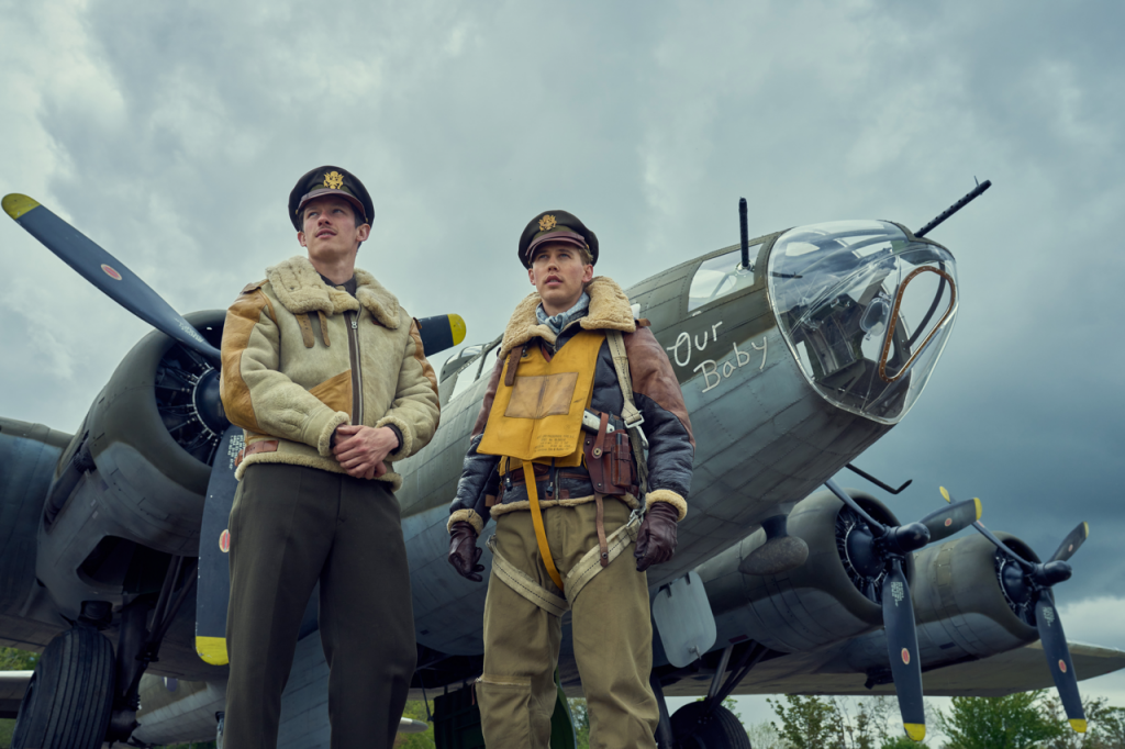
Steven Spielberg, Tom Hanks, and Gary Goetzman are the heavy-hitting executive producers behind Masters of the Air. They are renowned for their companion series Band of Brothers and The Pacific.
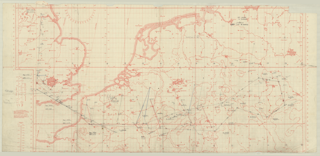
More than 100 maps and charts were provided by McMaster library to the production company in response to the request that came in 2021. Some of these materials can be spotted in the official trailer, which has amassed more than 5.3 million views.
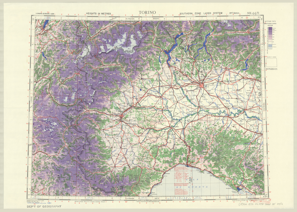
Most of the materials from McMaster date from the Second World War, with a few from the First World War.
Some of the items also come from the archive of Gordon Griffith (1914-2000), who served as the navigator of a bomber crew which formed in early 1944 and was attached to the 76th Squadron of the Royal Air Force. Griffith’s archive includes approximately 50 charts – including plotting (radar), aeronautical, and topographical, among others – that were used on his bombing missions.
“McMaster is proud to have a large collection of topographic maps that cover Europe, Asia, Africa, and even the Americas that were produced by the British War Office and the U.S. Army during WWII,” said Goudarzi.
“It’s great that other kinds of cartographic resources that were produced during the war effort, like the aeronautical charts and plotting charts found in the Gordon Griffith fonds are also being highlighted.”
Thousands of First World War and Second World War maps, as well as First World War aerial photos from the library’s print collection, are available online.
Library staff have also worked with the Canadian Warplane Heritage Museum to digitize their aeronautical and bomber charts. The digitization initiatives were led by the library’s retired maps specialist, Gord Beck.
Wade Wyckoff, associate university librarian of Distinctive, Legacy, and Digital Heritage Collections, says McMaster University Library is proud to offer extensive public access to an expansive and well-described collection of digitized maps from both the Lloyd Reeds Map Collection and the William Ready Division of Archives and Research Collections.
“McMaster’s rare maps, dating as far back as 1486, historical maps, and aerial photographs are indispensable resources for teaching, learning, and research,” said Wyckoff.
“The use of these materials in Hollywood productions illustrates their significance to artistic work and storytelling as well as more traditional teaching and research uses, and the importance of the ongoing work by our staff in acquiring, digitizing, and describing them.”
McMaster library maps have received star treatment in several high-profile Hollywood productions in the past few years. Recent credits include as Operation Mincemeat starring Matthew Macfadyen and Colin Firth, 1917 starring Benedict Cumberbatch and Colin Firth, and Fury starring Brad Pitt.
Learn more
WWII Topographic Map Series webpage

